
I meant to say at the beginning that when we started our trip we found these handy "Room Saver" books for each state. They had discounted coupons for hotels and motels. We saved over $1,000 on rooms alone and ended up with some pretty nice suites.
We travelled from Alamogordo to Las Cruces. No photo's here but we did have to go through a border check. It was a little unnerving because you have to drive up to a gate where they scan your car and ask for your papers. In the sky were helicopters and planes constantly searching the grounds. Millions of years before the dinosaurs, Las Cruces teemed with reptiles and amphibians, whose stories are told in the endless scattering of fossils in nearby mountains and deserts. Las Cruces was part of Mexico until 1848.
 After leaving Las Cruces we headed for Deming and the beginning of the Geronimo Trail. The Geronimo Trail Scenic Byway is named for Geronimo, a famous Apache warrior who was well known for his exploits. Because of Geronimo and the Apache love of the Black Range and southwestern New Mexico, it is fitting that the scenic byway be named for a man whose spirit remained with this country he considered his homeland. The photo's above and below are along the trail.
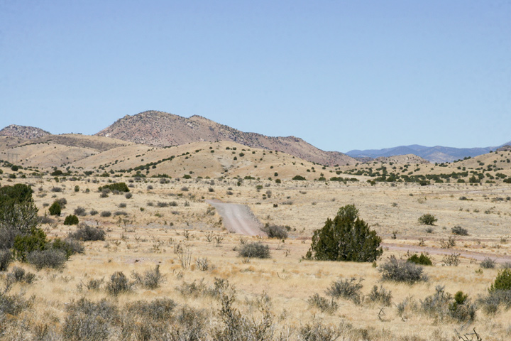
 It seemed that many of the signs we saw had bullet holes in them.
 This was outside of a road leading to a ranch.
 Love this sign and all the bullet holes!
 This is near Cuchillo on the way to Chloride.
 This is near Cuchillo on the way to Chloride. The New Mexico skies are such a beautiful, brilliant blue.
 This is near Cuchillo on the way to Chloride.
The ghost town of Chloride was the centre of the Apache Mining District. When a mule skinner, freighter and veteran prospector, Harry Pye discovered silver float in the Black Range Mountains in 1879, it would spawn one of New Mexico's biggest mining rushes.
 The Pioneer store was built in 1880 by a Canadian who went to Chloride for health reasons. In 1923, the owners closed the store, and boarded up the windows and doors, leaving all the furnishings and merchandise still inside. The current owners restored it and now on display, in addition to all the 1880s furnishings and merchandise, are many of the town records from 1880 until 1923 which had been stored in the building. Also on display are the tools used in prospecting, mining and assaying the ore. What a fantastic old museum, definitely a must see!
 The old saloon and dance hall is a little gallery and store that sells some of the local artisan's paintings, pottery and merchandise.
 Gotta love the satellite dish!
 This little H3 belongs to the couple who are restoring the old buildings. I love this!
 The "hanging tree" is in the middle of town. I was told that no one was ever really hung from the tree, there were a number of drunken and disorderly citizens who were first dunked and then chained to the tree until they came to their senses.
 I love this! Apparently at one time there was a full fence.
 This is the old "doodle dum" house, it is a native rock building. The house was built with a steep-pitched roof to resist severe hail storms. It was used for the past 30 years as Cassie Hobbs' "doodle dum" or workshop. Cassie Hobbs was a true frontier woman who designed and sewed all her family’s clothes and built (with just four tools) all the furniture in her house. Amazing woman!
 The fence is made by hand.
 If you look closely you will see the names "ma's" and "pa's" written on the doorways that led into the out houses.
 We came across these cattle crossing the road after we left Chloride.
 As we got closer to them they just stared at us.
 Still not moving, so I rolled my window down, said smile, and snapped the photo.
From the rugged Rocky Mountains to the desert grasslands of the Chihuahuan Desert, the Continental Divide Trail extends for 770 miles through New Mexico, a mosaic of azure skies, adobe architecture, ancient civilizations, “Wild West” desperados and red rock cliffs. The Continental Divide represents the height of land between watersheds between the Pacific and Atlantic oceans.
 Karen's shadow straddling the Continental Divide.
 I wanted to take the sign with me but it wouldn't come out.
 After all the excitement of the ghost town we came to a town called Truth or Consequences. I love that a town is actually named this. Originally named Hot Springs, the city changed its name to Truth or Consequences, the title of a popular NBC radio program. In 1950, Ralph Edwards, the host of the radio quiz show "Truth or Consequences", announced that he would air the program from the first town that renamed itself after the show. I had one of the best steak dinners I have ever had in this town.
No comments:
Post a Comment